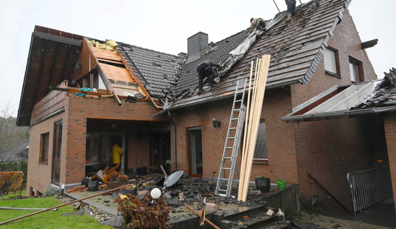
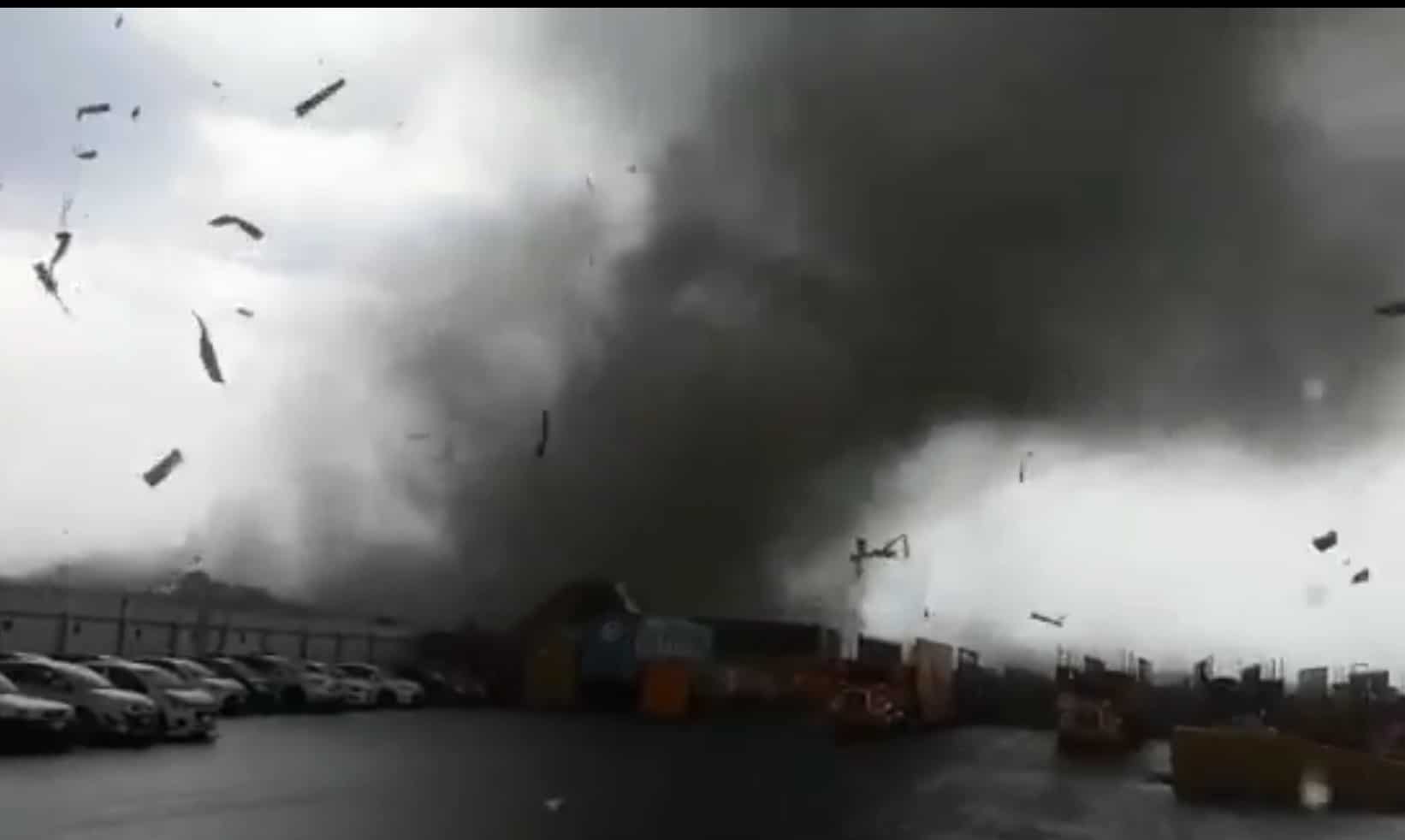
The hurricanes They are cumulus of air, although they do not last long, with their growth they get so much force, that they are capable of destroying from a tree to a building, leaving human and material losses as a result. We will expand all this information in the following.

What are tornadoes?
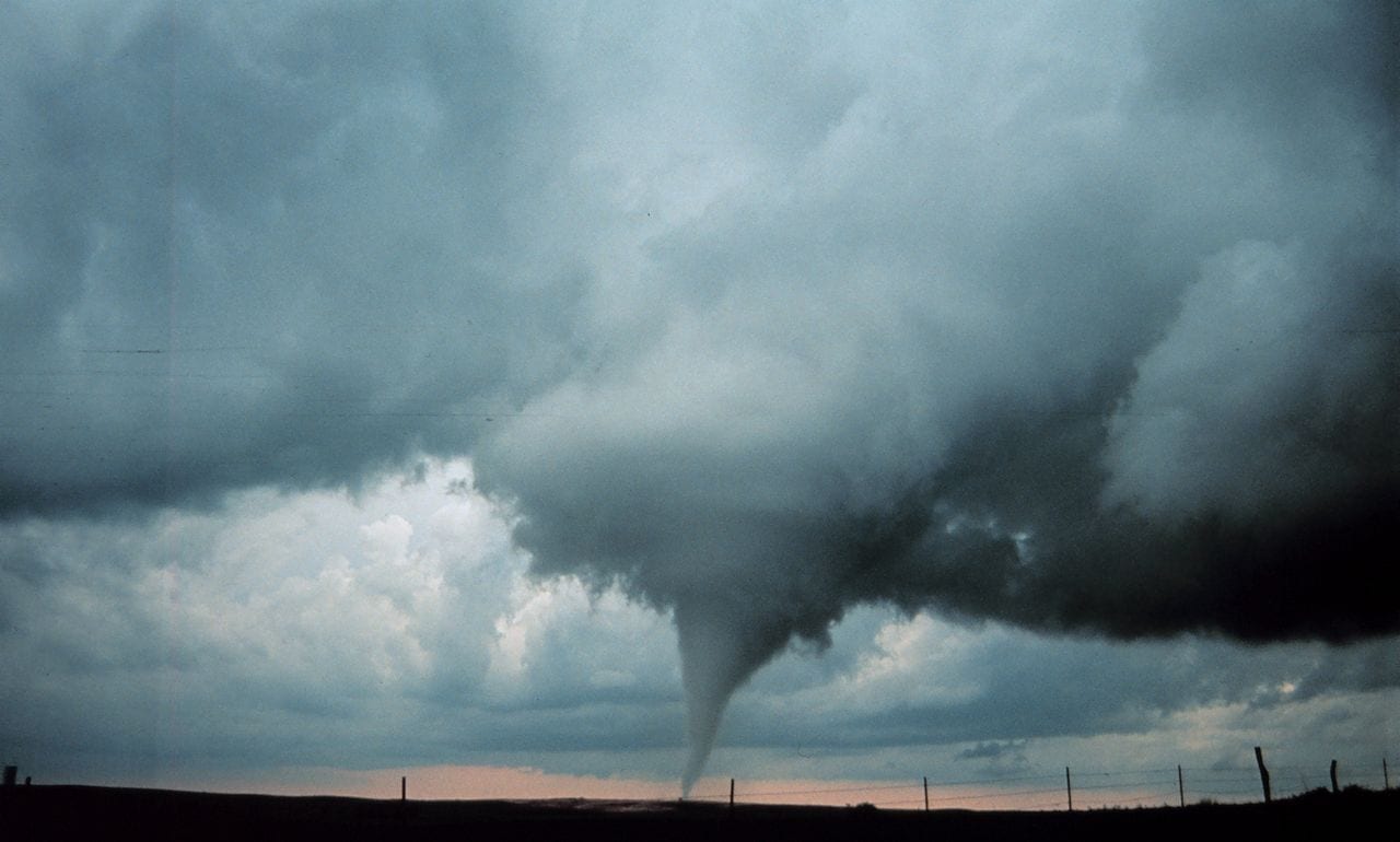
The hurricanes They are columns of air that generate high speeds, with two extremities, one that joins the ground and the other that is in the highest part, which makes contact with clouds called “cumulus”.
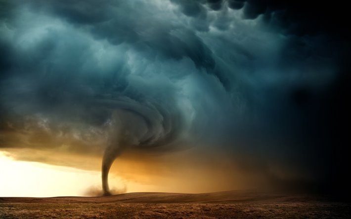
Among the atmospheric phenomena that occur on Earth, the tornado is the natural event that has the highest concentration of energy, its magnitude is estimated between ten seconds to one hour.
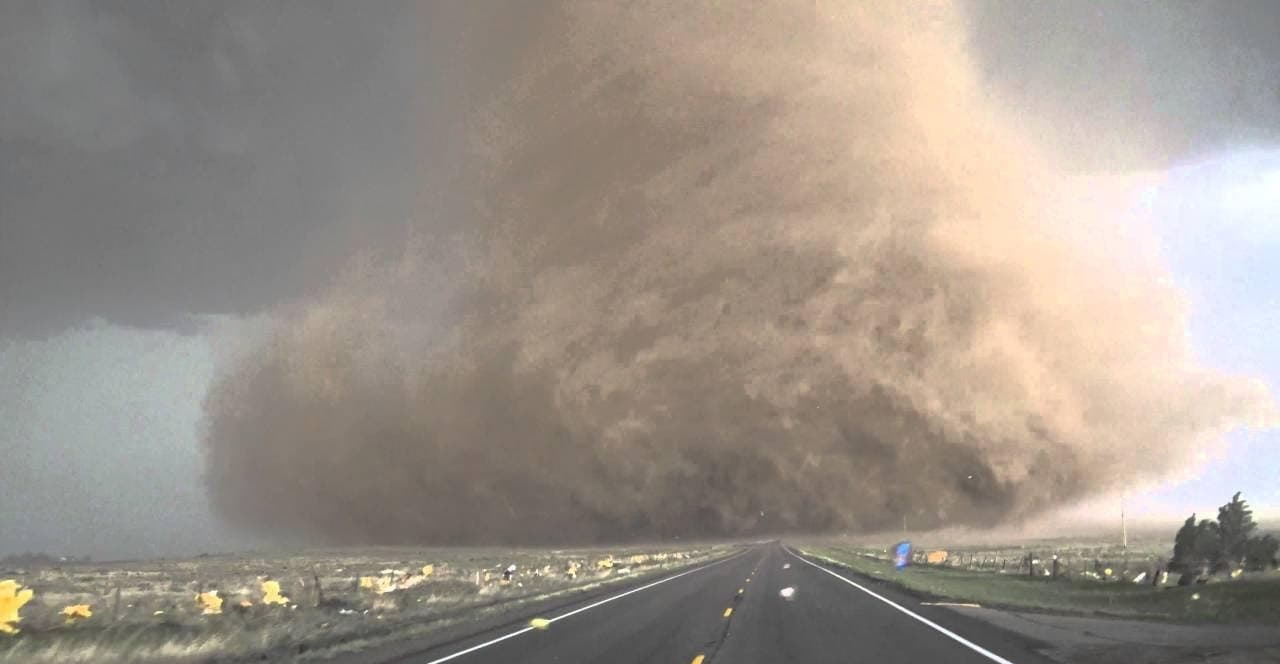
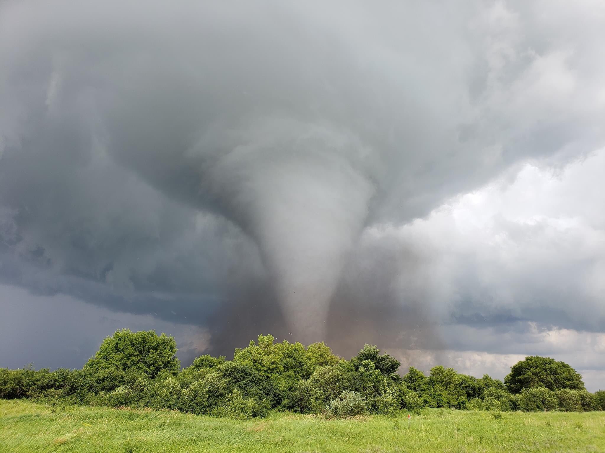
They can have different dimensions and various aspects, the most common is the figure of an inverted cone, in which the thinnest point is the one that has contact with the ground, carrying with it any type of material that is in its path.
In general, tornadoes can have a speed of 65 to 180 kilometers per hour, be 75 meters wide, with the ability to travel for many kilometers before they disappear.
There are records that the winds that revolve around it have reached 450 km/h, they can have a width of approximately 2 km and their displacement can be 100 kilometers in contact with the Earth's surface.
There are different atmospheric catastrophes of this type, among them are:
The vortices, those of terrestrial and marine waterspouts.
Those of a marine type make a connection with cloudiness of high dimensions, despite appearing in the oceans, it falls into the category of these phenomena, since its characteristics are similar to those that originate in the terrestrial area, they have a flow of wind which turns to form a cone.
These events are called "super cellular" since they originate above sea level.
Eddy currents can originate in intertropical regions, temperate areas, on the continental surface they are observed less frequently, in higher latitudes which are near the poles or in low latitudes near the equator.
There are other events with characteristics similar to those of tornadoes:
- liked
- microburst
- dust devil
- Fire swirl
- Steam swirl
The means of detecting a phenomenon of this kind is through the "pulse Doppler" radar, which is the tool that detects these natural events. The only continent where this phenomenon has not been detected is Antarctica.
Most of the sightings happen in North America, in an area cataloged "Tornado Alley" in the United States, then in South America there is the Corridor of Tornadoes that is located in the center and northeast of Argentina, southwest of Brazil , in Paraguay, in Uruguay, the affectation is throughout the country and this situation arises due to the size of the latter.
They can also be seen on the Asian continent, in southern Africa, throughout eastern Europe, in Australia and in New Zealand.
Tornado Categories
For the categorization of tornadoes there are different scales:
The “Fujita-Pearson” Scale: that gives results of the damage caused.
The old scale was replaced by the Fujita scale with updates.
- F0 or EF0 tornadoes are the lowest category, they do not have the strength to damage structures, they only manage to damage trees.
- The tornado with scale F5 or EF5, is the most powerful category, it can cause enormous damage such as collapsing buildings, skyscrapers, or deforming structures.
The TORRO Scale: It has scales that go from T0, which are the tornadoes with less force, to the tornadoes that have more force, which is the scale read as T11.
There are analyzes obtained by the "Dopper" radars and traces that were left on the ground such as cycloidal marks, photogrammetry images that serve to know the intensity and thus give the tornado a range.
Etymology
«The Royal Spanish Academy says that tornado refers to “thunderstorm”, this word is a loan word from the English language that means “thunderstorm”. It may be a word interpreted from the word return.
Tornado Definition
«In the Glossary of Meteorology is the definition of a tornado as: a column of air that turns violently on itself, being in contact with the ground, either hanging from or under a cumuliform cloud, and frequently (but not always) visible as a funnel cloud…”
In reality, the classification of a vortex as a tornado is used when it maintains contact with the ground as well as with the cloud base.
Scientists have not specified a definition for this phenomenon, they have not agreed, as to whether the lower end of the cone makes different contacts with the ground, that means there are several tornadoes. This term also describes the vortex of the air current, not the condensation cloudiness.
Funnel Cloud
Tornadoes are usually not visible, only when the center manages to have atmospheric pressure, then the wind and the turns increase their speed due to the cyclostrophic balance; they cause the liquid gas found in the air to end up condensing and these drops form a cone or as it is also called a condensation funnel.
This condensed cone expands to (50%) of the length from the ground to its base, this is approximately 2 kilometers, when all this transformation happens, it is when the tornado is formed.
Several differences have been presented regarding the concept of "funnel cloud" and "condensation funnel". The Glossary of Meteorology says that a funnel cloud is a cloud that is spinning hanging from a cumulus, they consider that for this reason most tornadoes are within that concept.
A large part of the meteorologists say that a funnel cloud can be rigorously defined as a cluster of clouds that rotate without being linked to strong airs on the surface, a "condensation funnel" is a definition used for any cloud that is rotating at the bottom of a cumuliform cloud.
At the beginning The hurricanes They are funnel-shaped clouds with few winds outside, only a few portions become tornadoes.
These phenomena can be predicted by a funnel cloudiness. Most cause strong blizzards outside, while the cone is far from the ground, making it difficult to tell the difference between a funnel cloud and a tornado in the distance.
Tornado Families and Waves
Sometimes when there is a storm and a tornado results, this can be parallel to or followed by it.
A family of tornadoes is called, those tornadoes that are generated in the same storm.
There are opportunities, in which several tornadoes can be seen to be born in a storm system. If its action is not prevented, it is called a wave of tornadoes, there are many ways to define them.
If it happens that several days in a row there are waves of tornadoes in the same sector, it is called a succession of tornado waves, it can also be called an extended tornado wave.
Characteristics of a Tornado
Among the characteristics, you can have the different types of events that have been studied, their shapes and dimensions.
shapes and dimensions
Tornadoes as a whole take the form of a cone, several hundred meters wide, at the base of this cone is a kind of cloud composed of materials that are found along the way, this can last very little.
Its color can become shaded, product of all the rain and the grit that it moves, this can be very dangerous, since it cannot be visible on many occasions, not even by meteorologists.
These phenomena can acquire various dimensions and shapes. The tornadoes that do not get to grow and do not take much force, are not visible, it is only noticeable as a kind of whirlwind of sand on the ground, when the winds that connect outside pass the speed of 64 kilometers per hour, they define as tornadoes.
When a tornado has a tubular figure with a not very high elevation, it is given an Anglo name "stovepipe tornado" which translated would be something like this: "stove tornado".
Large tornadoes that contain a single vortex are visualized as stakes driven into the ground, which is why they are called "wedge tornadoes."
Others can be very thick and look like a set of dark clouds, sometimes the width is so much that it exceeds its height.
Classifying tornadoes between wedge-type and low-separation cloudiness is difficult even for experts. Many of the tornadoes are wedge-shaped, most of the tornadoes that have large dimensions are of the wedge type.
When these phenomena are in their disappearing phase they take a tubular or cord-like shape, and may curl or form a kind of spiral.
They are told that they are in “sane phase”. When they are with this figure, the size of their cone becomes larger, this causes the winds that are in the center of it to weaken due to the maintenance of the angular period.
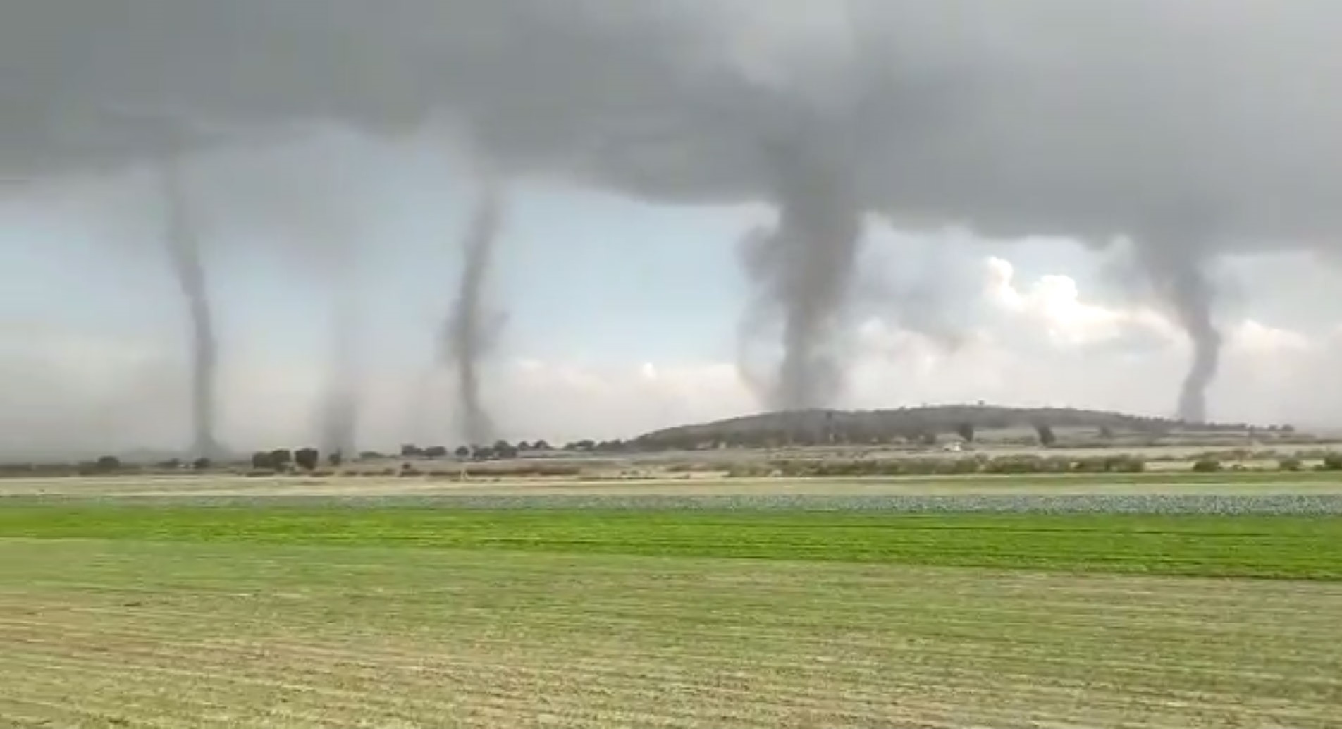
The hurricanes there are several vortices, which appear to be a kind of family of eddies rotating in a common point, or they are all shaded motivated by condensation, grit and all the remnants, simulating that it is a single cone.
In North America, specifically in the United States, some tornadoes have reached up to 150 meters wide and travel 8 kilometers in contact with the ground. Tornado measurements are very broad.

In the terminal phase of strong or weak tornadoes, they take on a slim figure, often measuring no more than a few meters.
At some point they reported one of these phenomena that came to have a zone of destruction only 2 meters wide. The hurricanes wedge-style can have an area of devastation more or less than 1,5 km wide.
There was a tornado that came to affect the town of Hallan in Nebraska, this happened in 2004, at one point its measurements were 4 kilometers wide at ground level.
There are tornadoes that seem to have traveled around 160 kilometers or more when the certainty is that they belong to a family of tornadoes that originate quickly one after the other; In the Tri-State tornado, there is no evidence that such a thing has occurred.
The appearance
The phenomena have a diversity of tonalities, it all depends on the area where they are established. Those that originate in dry localities will be invisible, barely visible due to the garbage that drags the base of the cone. Condensation cones that do not raise much debris or do not carry anything in their hues are gray or whitish.
When they move over a liquid matter, such as sea tubes, they circulate with white or blue tones. The slow-moving cones, trapping a wide variety of litter and sand, are shown in a dark hue, perhaps the hue of the materials they carry.
The phenomena that move through the plains have a red hue, due to the fact that most of the materials it carries is earth, while what originates in snowy mountains take on a luminous white color.
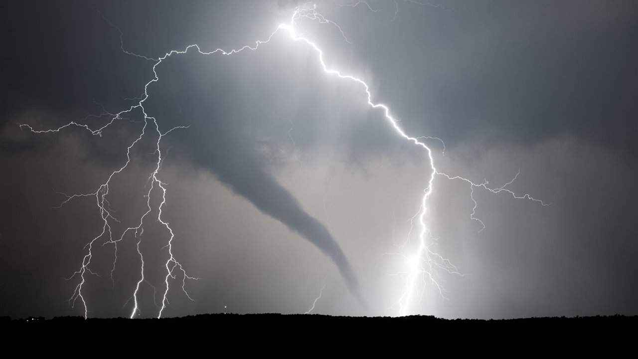
Lighting is one of the most important factors in your appearance. Some are backlit by the sun and your view will be darker.
If the sun is located in the back of the person who is observing it, the color that it will reflect will be an illuminated white or gray tone. If it is formed at sunset, it can have a wide variety of colors, highlighting pink, yellow and orange.
Some causes that prevent them from being displayed are when there is an upheaval of sand in the middle of a storm, the Rainy weather, hail and if it is night it would be another reason that prevents visibility. These are the most dangerous, since its location will only be known through weather radar, or through the sounds it makes when moving.
In general, strong tornadoes originate with the current that grows from the storm, it is free of rain, giving it the opportunity to be visible. Most of these phenomena originate at sunset. It is possible that tornadoes at night manage to be illuminated by some lightning that may appear.

There is evidence and images from “Doppler on Wheels” radars along with eyewitness reports, which say that this midpoint phenomenon is free and calm and with pressure that is very weak, similar to the eye of tropical cyclones.
The zone could be that it is free having winds, possibly calm, this area would be in total darkness, due to the fact that all the materials that are in the base block the light.
Those who have had the opportunity to be inside a tornado state that they were able to observe something because there was illumination in the phenomenon due to the electrical discharge of lightning.
Rotation
This type of phenomena is made by two kinds of perpendicular movements of the wind:
The first is descending anticyclonic: which has turns in a clockwise direction, composed of the cold and dry wind that descends and reduces its radius, due to the speed of rotation and the friction with the ground, generated by debris, leaves and sandstone.
The second is ascending: which makes up a cyclonic zone, where the radius grows in a screwed way, as it rises and rotates counterclockwise if it originates in the northern hemisphere, but if the tornado is in the southern hemisphere, the movements they are counterclockwise.

It is all or the reverse of what happens in the "descending anticyclonic funnel", while the cyclonic is rising, the high-temperature air becomes larger, causing its speed to drop, as well as its energy. These events and supercells rotate cyclonically simulating numbering even when the Coriolis effect is ignored.
Mesocyclones and this type of phenomenon that have a low level, obey a complex rotation that is found inside the supercell and its relationship with the environment.
In this phase this event can be visualized, because it is increasing its level and is in the process of cooling, the column of gas that is rising and condensing the vapor of this gas, causing the funnel-shaped cloud to form that as it goes increasing its size it grows.
Consequences of the Effect called «Coriolis»
Everything that has been said before, referring to the ascending turns that have a counterclockwise circulation, of the whirlwinds that are located in the northern part of the planet.
In the same way as those that turn to the opposite side and descend having a location also in the same area of the planet, as the creation of events that have the shape of a cord and move superficially, are the cause of the "effect of Coriolis”.
These events occur due to the enormous vertical dimension that these events have, when compared to their thickness in the surface area: the terrestrial rotation speed at 30° altitude is 404 m/s, this was pointed out by Antonio Gil Olcina.
As is logical, the speed has an intense consequence in the external zone, this causes the friction to rotate the gas column in a clockwise direction, of course this occurs on the north side of the Earth, at the height that is , the speed is lower, while the size of the funnel increases.
All these events begin their rotations in a clockwise direction and the perpendicular current contains a dry and cold wind that goes down following the figure of a spiral, while it makes its descent the dimensions of its turns decrease.
What generates that the speed of its turns increases and the restitution originates, then begins the screwed figure that ascends with the wind with a high and dry temperature, quickly forming a cloudiness like a funnel that when the temperature of the wind that is rotating drops cyclonic, which means that it goes against the clock on the north side of the planet and if it is on the south side it is anticyclonic.

There are two eddies in parallel rotating in different directions in the same center, it is what details the inequality of these phenomena: with an opening, where there is no agglomerated cloudiness, where there is not much height, at this point the icy wind descends and nothing wet and the other opening through which the hot and humid wind rises.
In some cases it manages to meet the cloud for the formation of cloudiness with a funnel shape that occurs due to the increase in the radius of the turns.
Only the processes that do not have great force as is the case of "terrestrial waterspouts", (the dust devil) or sandy storms; and the gustnados manage to turn clockwise, these turns can only be done by those that originate outside the cyclonic zone, on the back side in a "cyclonic supercell".
There are few occasions where these anticyclonic phenomena originate in conjunction with the meso-anticyclones of a non-cyclonic supercell.

Just like a cyclonic whirlwind, or what are called “companion tornadoes”, it can be with one of these phenomena that it is companion, of a satellite or associated with anticyclonic movements inside a supercell.
sounds and seismology
There are a large number of reports that announce a variety of noises that originate in these events, many times they are compared to other everyday echoes with scandalous alterations for those who have witnessed the event.
The comparisons that are made many times are like those of a train, a waterfall, motors and different combinations of all the aforementioned. In many cases it is difficult to hear the sound at great distances; everything depends on the conditions in which nature is found, the topography and the conditions of the atmosphere.
The vortex winds, the swirls, the exchange of the different air currents outside and the debris elements are what cause these noises.
Reports say that in the different cloudy funnels and in small eddies some noises have been heard, such as a kind of whistling, howling, buzzing of bees, murmurs or electric waves, there is also evidence of some intense and continuous dull sounds.
In many cases, the sound that is emitted by these phenomena is already perceived when they are close, so this fact cannot be trusted to know their arrival. Keep in mind that there are many similar sounds that can be heard as a strong blizzard, when hail falls or any strange sound.
Different samples of infrasonic seals impossible to hear can also be presented. These differ from the audible marks, because they were separated; Due to the long-distance transmission of sound waves with very low frequency, it is expected that the invention of artifacts that can detect these phenomena and also investigate their formation and dynamics.
The "tornadoes" can cause some seismic signal that can be felt, the observations on the subject are expanding to understand the process.
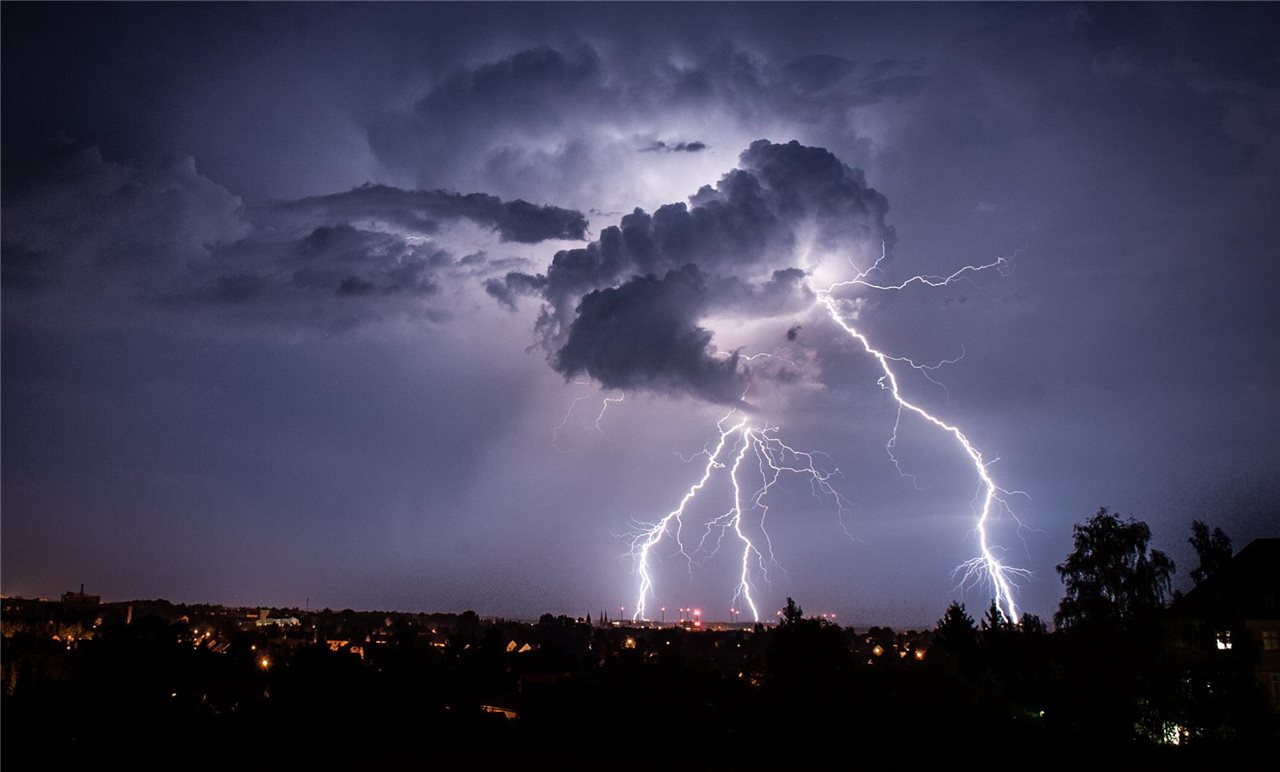
Electromagnetism, lightning and other effects
Tornadoes manifest themselves through electromagnetic images, and there are signs that they have detected atmospheric radio signals and also electric field signals.
Other detections that have been made are tornadoes and lightning activity. Tordible thunderstorms produce the same amount of lightning as thunderstorms, and the tornadic cell never produces them.
Almost always, cloud-to-ground (CG) lightning activities drop in level by the time a tornado reaches the outside and return to normal when it fades.
The cases are varied, in which the storms with tension and the tornadoes with high energy demonstrate an increase and special dominance of positive polarity in the release of CG type.
Electromagnetism and lightning are completely unrelated. Lightning does not incite the appearance of these, because lightning is thermodynamic phenomena, perhaps the only relationship that can exist between both events is the contact they have with the storm.
Many times some kind of light is reported, it is possible that it is only a misunderstanding due to confusing external lights of the phenomenon, such as lightning, night lighting, electrical installations with some damage, it is strange that the light comes from the interior and there is no information to the contrary.
The different winds, as well as these eddies, suffer atmospheric variations such as pressure, Temperature and Humidity.
Lifecycle
In the life cycle we will see the process that this phenomenon takes, its formation, maturity and disappearance.
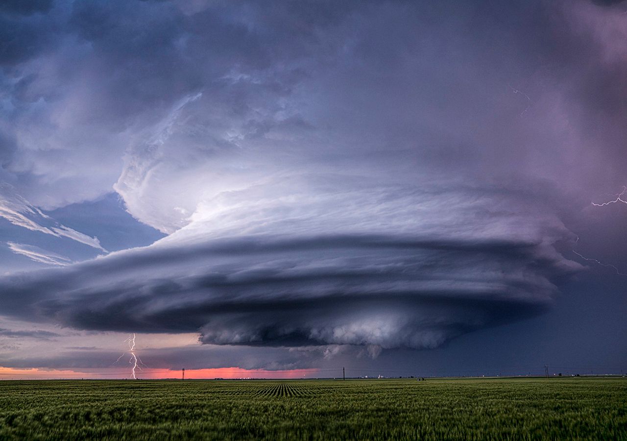
Relationship with the Supercell
Much of these phenomena begin with storms, this is known as "supercells". They include "mesocyclones", zones where the wind travels in the environment, with a width that can be from 2 to 10 kilometers.
Also included in storms: heavy rain, lightning, gales and hail.
These phenomena that are characterized by having strength and are established in the highest degrees of Fujita-Pearson, are the ones that originate "supercells", other events can be generated by the circulation of air, they are called "non-supercells", the they are characterized by having less intensity.
How are tornadoes formed?
The birth of the "supercell" itself takes place at the moment when the flow of cold and dry wind descends from the top of the cloud cover, often from the back, to support the warm air that rises from the front. , increasing the size of the cloud.
As the icy air has greater weight, layers of winds are generated that are not stable, causing the icy wind to go down, compulsorily driving the hot wind to rise, it is at that moment that the storm is created.
If the temperatures maintain a large difference, the drop of the icy wind can generate eddies, which are not visible as a result of the dry air: it is only visible when it is in contact with the ground and joins with the sandstone, debris and leaves.
The wind that is going down, they call it backside downdraft (RFP), picks up speed as it begins contact with the ground, dragging the "supercell mesocyclone" to its side.
The winds that go up, capture the nearby air, accelerating their turns, transforming into a thin wall, which is called a funnel cloud, the size grows and the rotation speed decreases as it ascends.
The process that has the icy and dry column of wind rotating in a clockwise or anticyclonic direction (starting from the top of the cloud that forms perpendicularly) with direction to the floor by the thickness of the cold air.
It shapes the condensation funnel (which can be seen) it rotates in a cyclonic manner, it is responsible for replenishing the volume of the cloud that previously fell, forming the cloudiness that makes the wall in the turn.
As the cone descends, with clockwise rotation (RFD) and makes contact with the ground, a gust originates that can be very dangerous if you are in areas close to it. There are frequent cases in which the funnel clouds transform into a "tornado" followed by contact with the RFD floor.
The maturity
At the beginning, this eddy has a large amount of gas with a high and humid temperature that enters to supply it with energy, managing to increase its size until it reaches the point of maturation.
The period of time that this process takes can be from a few minutes to an hour, in this part of the process it becomes a danger and reaches the point of maximum growth, reaching measures up to 1,5 kilometers wide.

As for the current that descends from the back side and is in a stage where its winds are external and icy, at this moment it begins to surround the tornado, stopping the current of wind with high temperatures that gives it life.
dissipation
The downdraft from the rear side surrounds the "tornado" and blocks the air intake, the vortex begins to lose strength and volume, simulating a cord.
It is the part where it begins to disappear, it usually lasts only minutes, then comes the disintegration of the tornado. The figure of the tornadoes in this stage will be proportional to the dimensions of the air carried by the main storm, making these figures varied.
Although it is in the process of disappearing, it still has enough strength to do some damage. By taking the thin tubular figure, similar to the position a skater adopts to go with more speed, it makes these winds increase their speed.
As it is already about to fade, the "mesocyclone" associated with the event loses strength from backside downdraft, as well as the influx of wind that energizes it.

When the first "mesocyclone" has disappeared and the attached tornado has disappeared, the storm current is dedicated to an area with proximity to the center.
If another "mesocyclone" forms, the routine begins again, creating one more tornado and another. The old mesocyclone and the new one often spawn tornadoes in parallel.
This is how tornadoes are born, evolve and dissipate. It is only a theory, it is very credible, there is no explanation regarding the formation of smaller phenomena, such as terrestrial waterspouts or those with a large number of vortices.
Individually they take part in their evolution, although the process is very similar.
Types of tornadoes
They are the types of phenomena that have similar characteristics or are part of the types of The hurricanes.
True Tornadoes
Multiple Vortex Tornadoes "The hurricanes”: which are called multiple or “multivortex tornadoes” are part of the natural phenomena in which there are a couple or more pillars of winds that rotate around the same center.
Multiple vortices can occur in different types of wind circulation, with more relevance being present in intense eddies. These vortices generate minimum areas that can do more damage to the transit of the tornado with more importance.
This event is different from the so-called "satellite tornado", which is a phenomenon that has no force and its formation is done next to a whirlpool that is strong and large, taking place in the mesocyclone.

“The satellite tornado” simulates being in Orbit around the main eddy, hence its name, resembling multi-vortex tornadoes. It should be noted that the satellite type has a different movement, with less size than the most important cone.
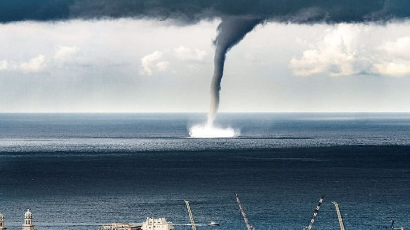
Waterspout: also called Manga de Agua are simply tornadoes that form in the water.
Scientists always recognize "tornadic" waterspouts from non-tornadic ones. The non-tornadic ones do not have much force, although they are more frequent, they resemble in their characteristics dust devils and also landspouts.
Its formation takes place at the foundation of cumulus congestus clouds in tropical and subtropical seas. Its winds do not present a great amount of force, its walls are completely smooth with laminar current and most of them travel slowly, if they manage to move.
One of the places where they are common is in the State of Florida, specifically in the area of the keys, also in the Río de la Plata, the Paraná River and in the north of the Adriatic Sea. In contrast, tornadic waterspouts are simply "tornadoes over the water."
His training on Seas and oceans, is similar to the formation of "mesocyclonic" tornadoes, these are formed as a result of a storm with great force and can have more intensity, they are fast and their duration is longer than non-tornadic waterspouts, they are classified as highly dangerous .
The Terrestrial Waterspouts: they are called "non-supercellular tornado", "tornado" or cloudy funnel, in Anglo language they call it "landspout", this type of tornado is related to mesocyclones.
It is named for the non-tornadic waterspout. "Waterspouts" along with landspouts have particularities that distinguish them: they do not have much strength, they do not last long, they have a smooth concise funnel and with not very large measures, in most cases they do not have contact with the ground.
When they touch the ground they form a cloud of grit because their function is different from that of mesoform tornadoes, they are weaker than known tornadoes, but they can still cause great damage.
Tornado-like circulations
Liked: It is a terminology that comes from “gust front tornado”, which means “gust front tornado”, it is a whirlpool of small perpendicular dimensions related to frontal gusts or gusts in descents.

Technically, there are no links with the base of the cloudiness, there are discussions that say that the gustnados are tornadoes.
They originate when a rapidly drying, icy gas stream results from a storm and is achieved with a set of high-temperature, moist, firm air near the edge of the stream, resulting in an arcing effect.
Being the wind shear located in the lower stages having an acceptable force, the turns can change position being now horizontal or diagonally and touching the ground. Remaining the gustnado.
Dust Swirl Type: It is also known as a sand or dust whirlpool, in the Anglo language it would be "dust devil" (dust devil), it is similar to "tornadoes" in the perpendicular twisting wall of air.
It always originates when the sky is clear and does not overcome the impulse that weak phenomena have.
It begins when a descending wind flow reaches the ground causing an "anticyclonic" eddy, which raises grit, debris and tree leaves, affecting homes or different buildings in a slight, medium or high category.
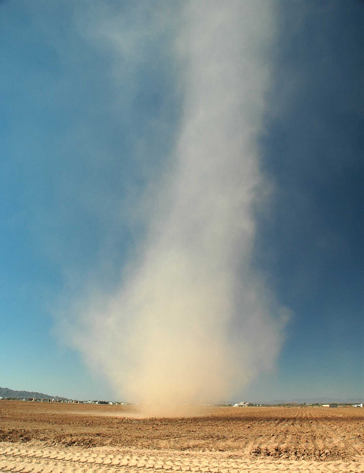
The fact that it forms on days with blue skies shows its meteorological stability, there is no heat transfer and nothing else exists in the descents of air towards the atmospheric phases that are at a lower level or in an atmospheric subsidence.
They are frequent at the beginning of spring, where the temperature is still freezing and the sun's radiation is intense.
Type Fire Swirl: are those movements that originate in the areas close to forest burning, they are also called "fire swirls".
They do not fall into the category of "tornadoes", they can only be called that way when they make contact with pyrocumulus clouds or with cumuliform clouds.
These types of eddies are weak compared to storm-related events. They can also be dangerous.
The Vapor Whirlwinds: This name refers to a twisting upward flow containing steam or smoke.
This phenomenon is strange, its formation is basically due to the smoke that is produced for example in the furnaces of a power plant, from hot springs and in deserts, they can start in the water when the icy air of the arctic encounters waters with warm temperatures.

The intensity and the damage they cause
There are different scales to measure the damage caused by these phenomena. There is the “Fujita-Pearson” scale and the “Fujita Scale”.
This new version, which has the acronym EF, uses air estimates and measures more accurately the mishaps caused; its first use was in the United States in 2007.
With an event with scale EF0, the weakest level, it can cause damage to trees, but it does not have the strength to damage structures, on the other hand, an event with scale EF5 considered the highest level and with greater strength, it can destroy buildings from their bases.
There is another scale called TORO that measures from T0 to T11, which are the most intense phenomena.
These phenomena have different intensities without taking into account the size, figure or place, it is common for the weak ones to be smaller than the stronger ones.
The lengths, distance and duration can change, tornadoes that move further have greater strength. There is a type of violent phenomenon, which shows high destruction energy where they have traveled, a large part of this energy starts in the subvortices.
In North America, specifically in the United States, 80% of these natural phenomena are classified as EF0 and EF1 (T0 to T3).
If the energy is high in terms of its range, the incidence rate will be low, it has been recorded that only 1% of these events have a high degree of violence (EF4, T8 or have greater force). In the case of North America and the "tornado Alley".
climatology
In the country where the highest percentage of tornadoes occurs is the United States, they are shown on different occasions surpassing European countries, without involving "waterspouts".
This is presented by the unique geography of the continent of America.
In the north of the continent, which is characterized by large intertropical regions from the Atlantic Ocean to the Arctic area, which does not have a large mountain system from east to west that can stop the air current of these phenomena in the regions.
The average of these events in the United States is about 1.200 tornadoes a year.
In the Netherlands there are about 20 tornadoes, which is the same as 0,00048 tornadoes per square kilometer in the year.
The United Kingdom per year originates an average of 33, making the conversion is 0,00013 per kilometer.
In Argentina in South America, about 30 have been registered in the year, equivalent to 0,0009 per kilometer, frequently in the area of the plains.
In Bangladesh, 179 people per year die from these phenomena, which is the highest percentage of all countries.
Due to the high population, poor quality buildings, there are deficiencies in security and prevention measures.
Their presence is common in the spring and they are not frequent in the winter. The events of these events are governed by the time, motivated by the sun's rays.
On planet Earth it is common for these phenomena to begin in the afternoon, with an average of 5 in the afternoon.
Those that are classified as violent can appear at any time of the day. There was a tornado in the year 1936 called Gainesville, which caused a lot of damage, it started in the morning at approximately 8:30 am
Association with climate
There is evidence that can certify that the El Niño Southern Oscillation (ENSO) is related to variations in the activities of tornadoes; There are changes depending on the season and the area, it also depends on whether the phenomenon called ENSO is "El Niño or La Niña".
The variations and Types of weather they can disturb tornadoes through teleconnections, as well as changes in source flow and different weather patterns.
It is not ruled out that global warming also affects tornadoes, this is not verified, since it is very complex, storms and everything related to the recorded data. All effects can make changes to the region.
Predictions
The omens of time are made regionally, there are several agencies at the national or international level that are dedicated to this topic. Many of them are only dedicated to predicting the realities that favor the evolution of tornadoes.
In Australia, there are numerous storm warnings which are reported by the Bureau of Meteorology in that country. It is currently modernizing its Doppler pulse radars, in 2006 they carried out six installations.
In the United Kingdom “TORRO” (Tornado and Storm Research Organisation), which means “Tornado and Storm Research Organisation”, makes test forecasts.
The Met Office makes verified predictions for the country, in the rest of Europe there is the project "ESTOFEX" (European Storm Forecast Experiment), "European Storm Prediction Experiment", provides weather announcements regarding the occurrence of bad weather , and the ESSL (European Severe Storms Laboratory) “European Severe Storms Laboratory”, maintains data records of all events.
In the United States, weather forecasts are made by the Storm Prediction Center, located in Norman, Oklahoma. They make predictions three days in advance.
Thunderstorm detection
After many trials to report on this type of natural disaster, this had its great boom after the year 1950, previously the only way to know that such a phenomenon was approaching was when someone saw its arrival.
Information of this type of a weather event was only made public after the event occurred.

When the metrological radar arrived, the places that were close to the weather stations were warned in advance of bad weather. The first announcement of the arrival of a tornado occurred in 1950 and the first warnings in 1952.
In 1953 it was confirmed that the echoes produced by the radar were related to these phenomena. When these patterns were already known, the experts, located kilometers away, detected storms that surely caused tornadoes.
radars
In recent times, a large part of the developed countries use meteorological radar networks, it is still the primary tool to locate future tornadoes. In the United States and several other countries, they use "pulse Doppler radars."
These Doppler radars measure the speed, radial direction, (if it is near or far from the radar), the winds of the storms, if the storm is at a distance greater than 150 kilometers, the rotation can be known.
Values may be lost depending on the distance between the radar and the event. There are situations that cannot be read by radar, events can be so fast that there is no time to read them.
The Geostationary Operational Environmental Satellite (GOES), has visibility of the entire planet, this is an advance for the observation of the places where a storm is beginning.
Storm Finders
The National Weather Service of the United States (NWS), in the 70s of the XNUMXth century, increased the need to prepare personnel who would be alert to storms and detect the primary signs of their formation.
For example, the presence of hail, strong winds and tornadoes, as well as the detection of the damage they caused.

Skywan was called this fact, the people who made up this group were the assistants of the Sheriff of each locality, policemen, firefighters, ambulance pilots, radio broadcasting operators, civil protection employees, storm chasers and all the people who wanted to participate.
When bad weather occurs, the climatic offices of each locality make the call to start the search work and notify the report.
These people are groomed by the NWS, representing each organization.
These organizations have a method to alert (a siren), the Emergency Alert System, makes the report to the NWS. In the United States there are more than 230.000 climate seekers who take their Skywam training.
In Canada, there is also a similar organization, called Canwarm, with a staff of about 1.000 volunteers.
In Europe, the organization is represented by different nations, with collector networks supervised by Akuwam Europe, Tornado and Storm Research Organization (TORRO), in the United Kingdom they have been since 1974.
Storm seekers is an important task, radar systems do not detect the tornado, they only give indications of its existence. The radars have signals, they can warn before it can be seen, then the locators can verify the existence or that its arrival is not threatening.

Observers have the ability to see what radars cannot, such as when you need to go beyond the distance that radar can detect.
tornado records
The Tri-State, is the event with the greatest force that has data, this phenomenon crossed three states of the country of North America, in the year 1925.
At present it had an "F5" classification, unfortunately at that time tornadoes were not classified.
Likewise, he is leading the list for the route he made, approximately 352 kilometers, with a time of three and a half hours, having a trajectory speed of 117 kilometers per hour, these amounts have not been surpassed worldwide.
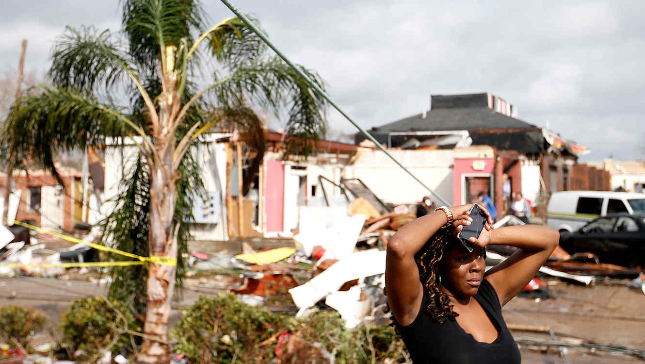
In the United States, it is the phenomenon of this type that has the highest number of deaths, around 695 deaths.
In the event logs of this type, with the highest costs, it is in second place in the history of saved data. After the updates of the norms regarding inflation and wealth, for these moments it is number three respects with the highest costs caused.
As for the tornado that has caused more deaths. Daulatpur-Saturia is located in Bangladesh. This happened in 1989, where 1.300 people died. Around 19 catastrophes of this kind have occurred in this place, with this it is said that 50% of the rest of the planet has occurred in this place.
Safety
Tornadoes are not predictable, it is not known when they may appear. Despite this, it can be prevented that the damage is stronger, educating people to take measures to be able to emerge unscathed from these environmental catastrophes.
Organizations similar to the Storm Prediction Center are dedicated to creating measures and plans in the face of these events.
When the alarm goes off regarding these atmospheric phenomena, people should immediately move to places equipped as dens, underground or bedrooms in places that can withstand these phenomena, to avoid a greater evil.
In vulnerable areas, most buildings have places to shelter while a storm occurs. This measure has been of great benefit, preventing further deaths from occurring.
There are meteorological agencies in countries that announce the arrival of tornadoes and warn when they think that an event of this type is being activated. The United States has a radio warning system that when the weather is uncertain they issue warnings, this is done regularly at the regional level. It is not common in other countries.
Meteorologists suggest to people who are driving vehicles when these events are taking place, to stand out of the way, avoiding blocking the path of the entities in charge of helping, find a place to take shelter. If it is impossible to get somewhere, it is best to find a ditch and stay there until the danger passes.