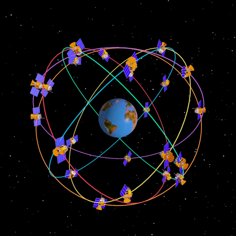
Did you know that GPS is made up of 24 satellites? In this article we will show you the history of gps, as well as its evolution from its creation to the present.
GPS history
The GPS, Global Positioning System, which has the original name Navstar GPS: It is a method that seeks to pinpoint the location on Earth of any person or car exactly.
This system was created by the United States Department of Defense. It currently belongs to the United States Space Force. To achieve the desired position, the navigator employs the use of four or more satellites, as well as trilateration.
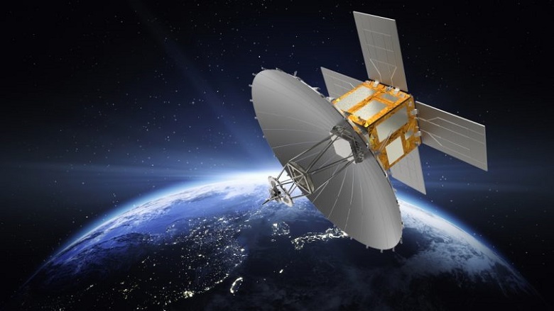
For its operation, GPS needs at least 24 satellites approximately at its disposal in orbit above the Earth, at an altitude of about 20000 kilometers. It distributes its orbits in such a way that it can have at its disposal four satellites identified in the whole earth.
By the 1960s, the OMEGA system, known as the Terrestrial Navigation System, based on signals from a few terrestrial stations, managed to occupy the first place in the world radio navigation system. However, as these systems presented certain restrictions, they saw the need to seek a greater response in navigation that was more accurate, thus beginning the history of GPS.
The Armed Forces of the United States made use of these navigation advances in the history of gps using satellites that allowed it to visualize exact and punctual positions.
The system used had to meet certain provisions to be executed. Have globality; in this case the globe had to be completely encompassed, be persistent and his work had to be continuous, without being disturbed or limited by the atmospheric state. As well as being energetic to allow it to be precise.
In 1964 a new system called Transit was in the works, and by 1967 it was used by the military for commercial use.
This system was structured by six satellites of low polar orbit, with 1074 km of altitude. They allowed worldwide coverage to be achieved, but not persistent. Its possibility of location was not constant, access to satellites was given approximately every two hours. To calculate its position, it had to be monitored every 15 minutes to prevent it from losing its range.
The US Navy, in 1967, advanced with a satellite called Timation, it showed the assertive possibility of placing exact clocks in space that would provide consistent data, an advance that went hand in hand with GPS.
In 1973 the programs with which the United States Navy and Air Force worked were united and the so-called Navigation Technology Program was launched, which means Navigation Technology Program.
From 1978 to 1985 they unveiled and had eight Navstar experiment satellites. After them, new generations appeared, until reaching the constellation that is currently known as the initial operational capacity, a name given in December 1993, with a total and useful capacity by the year 1995.
In 2009, the United States developed a service that allowed establishing the position and helping ICAO, which did not refuse to accept the offer. Thus little by little the history of gps was formed.
Characteristics and forms that were developed in the history of gps
- It features 24 constellation satellites representing between 4 and 6 orbits.
- It has an altitude of 20200 km.
- Its period is between 12 sidereal hours.
- It has an inclination of about 55 °.
- Provides a favorable life of 8 years.
- Its coverage is worldwide.
- The user capacity has no limits.
- Within its coordinate system it works with 8000.
signal in gps history
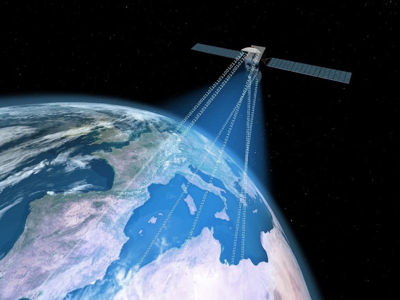
Within the history of gps we find that it continuously sends a navigation message at approximately 50 bits per second in its 1600 MHz microwave transfer structure. For FM radio it is sent between 86 and 109 MHz and for wi-fi it works with an approximate of 5000 MHz and 2500 MHz, in itself the satellites as a whole send 1600 MHz for the L1 signal and 1228 for the L2 signal.
This gps signal provides the time, the time that corresponds to each week, using an atomic clock that is inside the satellite, it also shows the number of each week, and designs a reference that allows you to discover if the satellite has any fault.
Its broadcasts are 30 seconds long with 1500 bits of data available. The data numbers are established by high-speed pseudo-random tracking that characterizes each satellite.
Its emission is timed, it begins and ends at the same time, as indicated by the clock inside the satellite. At first, the information receiver is informed of the existing link between the satellite clock and the time indicated by the GPS, and at a second moment, it sends the information to the transmitter of the exact orbit of the satellite.
gps system evolution way
- A new signal for civil use is added on L1.
- Likewise, a new civil signal is added to L5 with an approximate of 1177 MHz.
- In addition, a form of care is established for the new signs of Security for Life services.
- Provides better signal distribution.
- Improves signal strength.
- An increase is made in the monitoring boxes, they rise to 12.
- Access the interrelationship with Galileo's L1 continuum.
- Meet the lines of customers, whether military or civilian in the use of gps.
- Determines gps III requests according to the forms of operation.
- It facilitates the necessary permissions in the future transformation in order to satisfy the requests that users are willing to make until 2030.
This system has achieved a great advance that has allowed to actively establish a location in the scope of the data, which allows the client to determine the exact movement of the well-known Mobile Mapping.
With this method, 3D cartography is used, through a scanner that has a laser, measurements are made from cameras, sensors, gnss systems, allowing to accurately identify, hand in hand with its three location technologies: IMU, GNSS and Odometer, who they achieve a signal range, even in those places where it is not good.
how gps works
The history of gps has shown great advances, within them their functions have been updated, among them it is worth highlighting:
- Within its functions, GPS marks a pattern called ephemeris, which is why each one sends their own individually, in which the life of the satellite is established. how it is in space, its time, its doppler content, among others.
- The separate satellites show that the one in charge of receiving the information is located in a specific space on the surface of the sphere, its north is the same satellite and its radio is the exact distance to the receiver.
- Once the information emitted by two of the satellites is received, a contour can be established that is the result of the two spheres in some specific space, in which the receiver is located.
- When the information from satellite number three is received, the fault that prevents the clocks from being related to each other and the gps beneficiaries disappears, achieving a precise 3D position.
If you want to enrich yourself with some other technological topic, I invite you to follow the link Satellite technology
Reliability of the information emitted by a gps
Since the GPS has a military line, in the United States, the Department of Defense keeps the probability of assuming a small one at random, which could be modified between 15 and 100 m. However, at present this driven error is not used, the exact and precise information sent by the GPS is related to the number of satellites that can be observed at a specific time.
If the information received is between seven and nine satellites and they are inconsistent, their measurements are below, it could be between 2 meters in 95% of the time, if on the contrary the GDPS system is used, the accuracy of its measurement is much better, since it represents 97% of the circumstances.
The reliability of the data provided by a gps depends on its form of position, to accurately and precisely measure the location of the receivers.
As we can see, there are many advances that occur in the history of GPS.
Origin of gps error in your history
The information that a gps measures needs at the moment, the location of the satellite and the delay in the signal that is received. Its accuracy is due to the accuracy of the position and the delay of the signal.
When detecting the delay, the person in charge of receiving the information relates a number of bits sent by the satellite with a personal interpretation. When the terms of the series are related, the electronic components establish inequality of 1% in a bit time; hence the signals emitted by gps extend at the speed of light, which establishes a fault of approximately three meters, it is considered a very small fault when the gps signal is used.
Accuracy can be improved by using a P(Y) signal, showing the same result, which represents 1% of the time, the P(Y) signal, in high performance, shows an accurate conclusion of about 30 centimeters.
The accuracy of the gps measurements are influenced by the faults that arise from the electronics. These ways of measuring can be improved with the use of software and methods used in real time.
If you want to know about the evolution of GPS, I invite you to watch the following audiovisual content.
Within the margin of error in the history of gps, we can consider:
- Delay in signal emission in the ionosphere and troposphere.
- Signals that are shared at the same time in buildings and mountains and are returned.
- Faults in the orbits, where the information of the same ones are not exact.
- Number of observable satellites.
- Inequality in the location of the satellites that can be viewed.
- Errors in the internal gps clocks.
Elements that intervene in the errors of the emitted data.
The elements involved in the errors that have occurred in the history of gps are related to:
Unique satellite errors in gps history
- Errors in the orbits: Adequate elements are necessary to drive the orbits, since the satellites do not have a direct line to the Kleperian orbit, which is what is considered normal, this has the consequence that the process is interrupted due to lack of knowledge of the energy that influence each satellite.
- Faults in the internal clock: It is related to the alteration in the time of the internal clocks that are caused by the loss of the oscillators and those that are caused by the movement of relative effects, which brings as a consequence a great difference between the time which is established and the satellite.
- Position errors: It is the lack of security that arises from the location as an inference from the lack of position accuracy and the chosen satellites.
Errors in the forms of transmission in the history of the gps
- Faults in the ionospheric reinforcement: It is related to the GPS frequency, the error in its reinforcement appears from 50 meters to 1 meter, the ionospheric strength depends on the regularity and the approximate effect of each measurement that is made.
- Faults in the tropospheric reinforcement: These errors mark a margin between 2 and 25 meters, this is separated from the regularity of the measurement. However, this error can be corrected using other tropospheric models.
- Multipath: This way allows the signal to arrive using two different sources, although this can cause the signal to be interrupted. The use of Multipath is noticed when measuring surfaces, to underestimate its shape, an antenna can be used that works with the signals it receives from different environments.
Errors directly related to the reception of information in the gps history
- Noises: Noise is related to the amount of information and the time needed to obtain it accurately, this must be followed to obtain measurements accurately.
- Antenna information centers: If a known error is found in the role of the antenna in the measurement, the points are canceled, when the measurements are accurate, the antennas are aligned in the same direction in order to obtain the desired results .
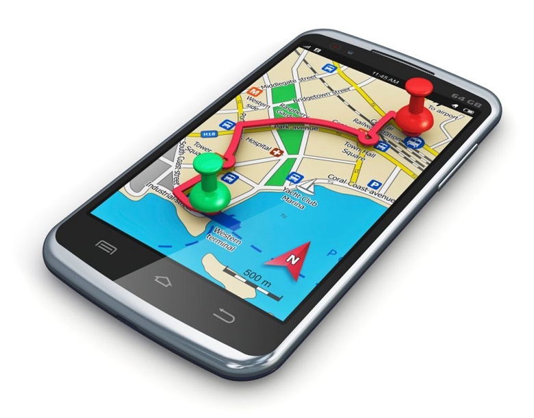
Incorporation of gps to cell phones
At present, the use of gps in telephones has acquired a great boom, it has been introduced into smartphones, being very useful when it comes to requesting an address, the use of gps has given rise to a software method for different types and models, as well as the different types of businesses that require the use of mobile phones.
It gives us the possibility of knowing the places where friends and family are through a map, it is only necessary to have the required platform.
Incorporation of GPS in watches
The advancement of technology today has made it possible to give way to smartwatches with GPS included, they can be used with smartphones if we refer, for example, to sports watches or bracelets that do not have screens.
Like smartphones, this allows us to know the location of the people we want, it is only necessary to have the necessary application and platform.

The Theory of Relativity and GPS
In GPS satellites, the clocks need to be related to the locations on the ground, so the general and special theory of relativity must be considered, the effects that they provide are: time, frequency changes and eccentricity.
On the other hand, in terms of time the speed of the satellite oscillates between 1 part in 10, this expansion results in the satellite clock being in an approximation of 5 parts in 10 faster.
Regarding spatial and general relativity, starting from the theory of relativity, because it is constantly in motion and the height it represents, affects the speed of clocks, general relativity states that a clock closer to what it wants to measure will be much slower than one that is further away, if we relate it directly to the gps, what you want to obtain the information is closer to the earth than to the satellites.
The use of gps has now become a great tool, both for relationships and work, which is why it is necessary to know how it works from its origins to know its scope and get the most out of it.